谷歌“虚拟卫星”AI 模型问世:可提供近乎实时的地球视图

市场资讯
31 Jul

  炒股就看金麒麟分析师研报,权威,专业,及时,全面,助您挖掘潜力主题机会!

(来源:IT之家)

IT之家 7 月 31 日消息,谷歌今日发布了一款名为 AlphaEarth Foundations 的全新人工智能模型,该模型被形象地称为“虚拟卫星”,旨在为地球观测领域带来变革,可以帮助研究人员追踪地球随时间推移发生的变化。

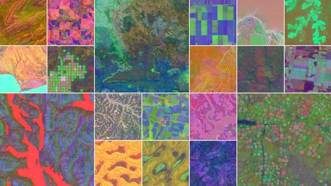
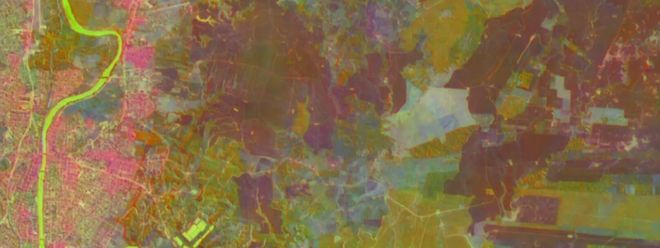
据IT之家了解,AlphaEarth Foundations 使用了一种名为“嵌入”(embedding)的系统,其工作原理是每天从多种来源收集大量公共信息,包括光学卫星、雷达以及气候模拟数据等,并将这些数据整合在一起。随后,该模型将陆地和沿海水域划分为 10 米 ×10 米的方格,并对这些方格进行长期分析和跟踪,这些方格会根据不同的特征(如植被类型和物质属性)被赋予不同的颜色编码。

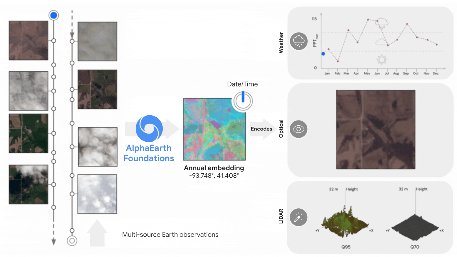
谷歌表示,AlphaEarth Foundations 的一大优势在于其能够为每个监测的方格生成所谓的“高度紧凑摘要”。与同类 AI 系统相比,这些紧凑摘要所需的存储空间可降低至 1/16,从而大幅降低地球观测的成本。

那么,该模型的数据究竟可以用于哪些领域呢?谷歌解释称,科学家可以利用 AlphaEarth Foundations 按需创建详细的地图,用于多种用途,例如监测农作物健康状况或追踪森林砍伐情况。

谷歌在声明中提到,该模型在不同时间跨度的多种任务测试中表现出色。谷歌表示:“AlphaEarth Foundations 在理解我们不断变化的地球的状态和动态方面迈出了重要的一步。”

在过去的一年中,谷歌已让超过 50 个组织访问了该模型的 Satellite Embedding 数据集,即其年度嵌入数据的集合,以便这些组织在实际应用中测试其效用。如今,谷歌已将该数据集发布在谷歌地球引擎(Google Earth Engine)上,供其他科学家用于自己的研究工作。

海量资讯、精准解读,尽在新浪财经APP

Disclaimer: Investing carries risk. This is not financial advice. The above content should not be regarded as an offer, recommendation, or solicitation on acquiring or disposing of any financial products, any associated discussions, comments, or posts by author or other users should not be considered as such either. It is solely for general information purpose only, which does not consider your own investment objectives, financial situations or needs. TTM assumes no responsibility or warranty for the accuracy and completeness of the information, investors should do their own research and may seek professional advice before investing.

Most Discussed

  1. 1


  2. 2


  3. 3


  4. 4


  5. 5


  6. 6


  7. 7


  8. 8


  9. 9


  10. 10